Enjoy Skellefteås coast & archipelago

High cliffs and deep bays characterise this part of the Bothnian Bay. In several places there is a sense of being in the outer archipelago even while still on the mainland. Skellefteå municipality has the longest stretch of coast in the country and, because several rivers run into the sea, there are many natural small beaches and harbours along the shore. Which means many exciting places to visit.

In this guide, we take you on a journey along the coast of Skellefteå, starting in the north, showing you destinations on the way and ending in the south. The guide has been produced in collaboration with the Bottenvikens Skärgård.

Pite-Rönnskär

LIGHTHOUSE, FISHING SETTLEMENT AND WEATHER STATION

Pite-Rönnskär is a former lighthouse and pilot site, these days famous from radio weather forecasts. For the past century, the 37-metre-high Heidenstam lighthouse, known as the "Queen of the Lighthouses", has stood watch here. For those who want to spend the night, there is a nice guest harbor, but also a hostel. From the harbor in Kinnbäck, a boat taxi departs to Pite-Rönnskär.

Deep inside the spruce forest on the northeastern of the island is a mythical rock block, called Klockstenen. Every time the church bells ring to call the congregation to worship, the mighty, moss-covered boulder is said to turn 90 degrees clockwise.

Discover Pite-Rönnskär

4 P6023373 Piterönnskär

Byske

SCRAP WOOD JETTIES & SAWMILL ERA

In the middle of the 1500s, Båtvik was used for summer pasture by Byske's landowning farmers and it would be another 100 years before Båtvik had its first permanent homestead. At the beginning of the 1870s, a sawmill was built where at most 100 people worked, but which was closed down as early as 1892. Many remains remain to this day. At the pier there are guest berths for boats and right next door is Båtviks marina.

16 Hamnskar

Hamnskär

Hamnskär is located out in the Byske Bay and is a rocky, nature‑rich island that was formerly a pilot station. Here, visitors can tie up at the floating jetty and enjoy a simple overnight stay or a day trip, with barbecue areas and a communal sauna. Because the island has no running water, you need to bring your own drinking water and prepare meals at the grill sites or with a camping stove.

Book a boat taxi or tour boat

Furuögrund

MEMORIES FROM THE SAWMILL ERA

The village’s glory days are linked strongly to the period 1874 to 1925 when the sawmill was in operation. Furuögrund has a fine harbour that is well protected from winds, and the guest jetties have a good depth, even for yachts. The old harbour warehouse has a summer café. Housed in a beautiful building on the beach just north of the harbour, is a tide gauge from 1914.

Halsön & Romelsön

WITH ROOTS FROM THE VIKING AGE

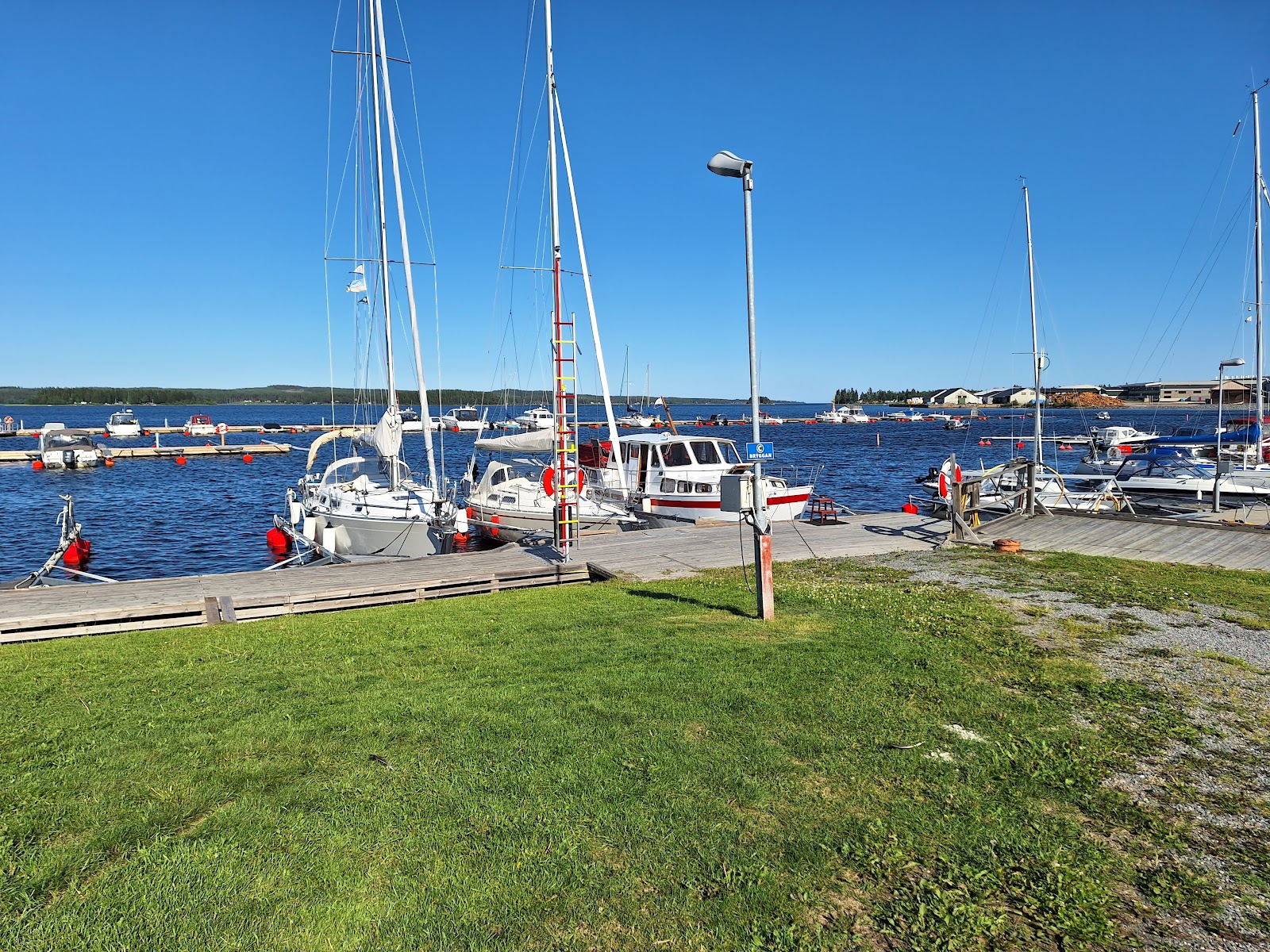
South of Furuögrund lie the islands Halsön and Romelsön. Both are very popular destinations for those with access to a boat. During the summer months, there is also the opportunity to book a boat taxi to the islands.

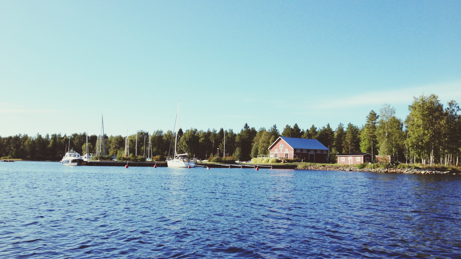
Halsön, like several other islands in the Bothnian Bay archipelago, has a history connected to the sawmill industry. At the end of the 19th century, there was a steam sawmill on the island. Byske Boat Club has its clubhouse on Halsön, with a veranda, electricity, and summer water. There is also a barbecue area, wood-fired sauna, and dry toilet. Below the sauna is a small sandy beach. Here, you can borrow a canoe and windsurfing boards without sails for play. The guest jetty has about 30 berths. There is also a defibrillator on site.

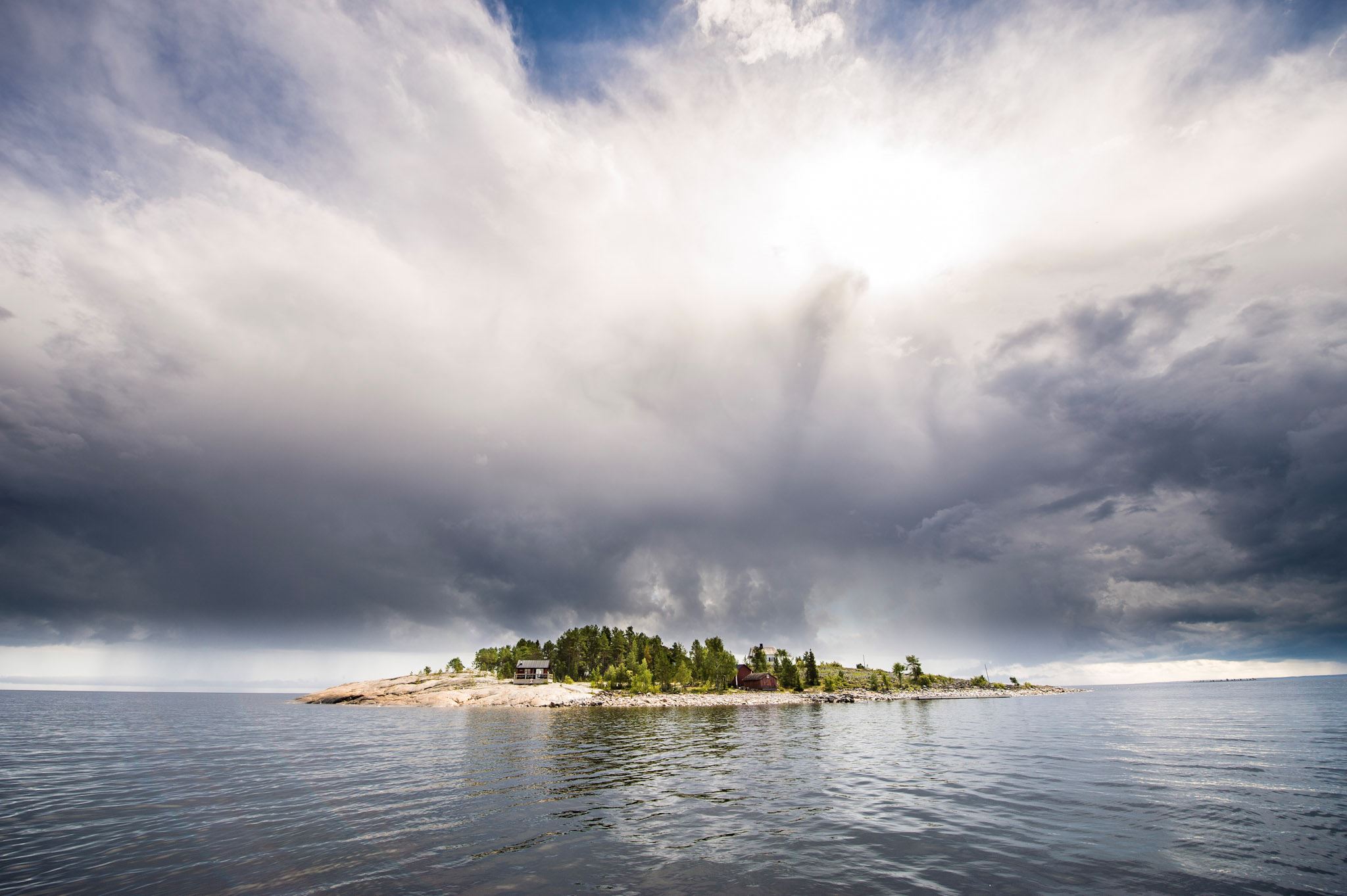
Romelsön has roots dating back to the Viking Age. Archaeological finds, including house foundations, a belt fitting, and a stone labyrinth, show that the island was inhabited and an important center for fishing and seal hunting as early as the Viking Age. In 1652, Queen Christina granted Romelsön with fishing rights to the town of Piteå, which still owns the island, despite it being geographically located in Skellefteå Municipality. The nature on Romelsön is very diverse, with sandy beaches, shingle fields, rocky outcrops, heathland pine forests, coastal spruce forests, and a couple of larger lakes and tarns. Sandviken on the island is a popular sandy beach where smaller boats can land, with a barbecue area and dry toilet.

Kåge

BOATING, BATHING AND CLIFFS

Kåge marina is Skellefteå's largest guest harbor, located inside Kågefjärden. Just outside Kåge marina is the island of Bastuholmen with the much visisted Lillhällan, which is wheelchair accessible. Lillhällan has smooth, bath-friendly rocks that reach almost down to the water. From Lillhällan there is also a walking path to Storhällan on Bastuholmen's westernmost point which has an observation rock with with barbecue area. If you do not have your own boat, you can take a boat taxi from Kåge marina.

Lillhällan

Lillhällan has smooth, swimming-friendly cliffs that stretch almost all the way down to the water. From Lillhällan, a walking trail leads to Storhällan on the westernmost point of Bastuholmen, which features a high lookout cliff with a barbecue area. From the jetty, there is a wheelchair-accessible ramp that leads up to a wooden deck with picnic tables.

Bergskär

The hilly island of Bergskär is located at the entrance to Kågefjärden and is today a popular excursion destination. The island is characterized by its lighthouse, which was put into operation in 1893. The landscape mainly consists of rocky outcrops and sparse forest. The island invites exploration among military remnants or picnics on the cliffs.

Skellefteälven

FROM THE SEA TO THE CITY

In the mouth of the Skellefteälven river, in Skelleftehamn, you will find Kurjoviken. A trip along the Skellefteå river takes you from the open sea into restaurants and shopping in Skellefteå. On the way, you pass under bridges, through locks and past a number of suitable guest piers. From Kurjoviken, a boat taxi departs via Örviken to Gåsören.

Detailed facts about the boat route can be found in the folder "By boat along the Skellefteälven" which is available at Skellefteå Tourist Center. It can also be downloaded from the web.

Burehällorna, Sarasand & Kollostranden

These idyllic natural areas with smooth, polished rock outcrops and beautiful, inviting sandy beaches with reed beds, surrounded by sparsely wooded pine heaths, are popular destinations and gathering spots—for both boaters and visitors arriving by car.

637586551978252060Burehällorna

Burehällorna

Burehällorna is a nature reserve featuring smooth, polished rock slabs that slope down into the sea, alongside a small sandy beach. There is also a sauna open year round. It is a cherished excursion destination with a long-standing tradition and many carvings that testify to visitors over the years. The outermost rock, Trappman's slab, is also known for the local legend of the soldier Trappman from Uttersjön. Trappman ran aground on the slab during a stormy autumn night in 1863 when his boat sank. He made it ashore but froze to death and was found kneeling with his hands clasped in prayer.

Sarasand

Sarasand, southwest of Burehällorna, is a beautiful bathing bay well worth a visit. There is access to a grill area and an outhouse.

Burvik, Kollostranden

Kollostranden got its name from a children's summer camp in Burvik that operated between 1938 and 2010. The camp is now closed, and compared to Sarasand, this beach is located a few hundred meters further into the bay. Here you'll find a guest dock with electricity, a sauna, outhouse, wind shelter, and grill areas.

149 DJI 0305 Bjuröklubb

Bjuröklubb nature reserve

LIGHTHOUSE WITH A MAGNIFICENT VIEW

Even as far back as the Bronze Age, when sea levels were about 30 metres higher than today, temporary settlements existed here. Few places along the Norrland coast have as many remains from fishing and seal hunting as Bjuröklubb. Many of these can be seen along the archaeological trail that winds over rocky ledges and fields of cobblestones. In 1859, the lighthouse that still shines today was built. From the top of the lighthouse, you are rewarded with a sweeping view over the Bothnian Bay.

Upptäck Bjuröklubb

Bäckfjärden

Bäckfjärden has an inner archipelago made up of many islands and skerries. The bay is rich in aquatic plant species. A part of the bay is included in the Natura 2000 network, making it especially important to protect and preserve. On Bergskäret, ships were built for the merchant fleet in the late 1700s.

The village of Risböle used to have its summer pastures out on Storön, where villagers would take their cows for autumn grazing. In the village of Bäckån, the Risböle fäbod trail begins — a 9-kilometre hiking path that winds through forest, along sea and shoreline, and ends at Risböle’s summer pasture. Along the way, you can take a swim at the beach in Storsand, where you’ll also find a wind shelter and a dry toilet.

As the name suggests, Kalashällan in Bäckfjärden is a popular boating destination, featuring a grill area, dry toilet, and guest piers. Everything from church services to traditional Swedish midsummer celebrations has taken place here.

Kolgrundet has a small marina and remnants from an old sawmill site.

Munkviken

HISTORIC CAMP SITE

By the sea, just south of Lövånger, lies Munkviken, best known for its camp site. The facility, which opened in 1941, has developed into a popular destination that still welcomes thousands of visitors each year. There is also a well-loved café, a beach, and a guest harbor.

Juviksskäret

SMALL COVES AMONG SMOOTH ROCKS

Juvikskäret lies at the southernmost part of Skellefteå municipality’s coastline. It is a small island with sandy beaches nestled between rocky outcrops. Beyond the island stretches the open sea.

On Juvikskäret, you’ll find rock formations, shingle fields, and untouched forests of pine, spruce, and rowan. The lichen flora in these woods is highly valuable for conservation, with several endangered species. The island is well-visited both in summer and winter. It features a few wind shelters, fire pits, two swimming beaches, and dry toilets.